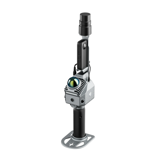
CHCNAV AlphaAir 9
The AA9 simplifies the process of capturing 3D reality through a streamlined workflow.
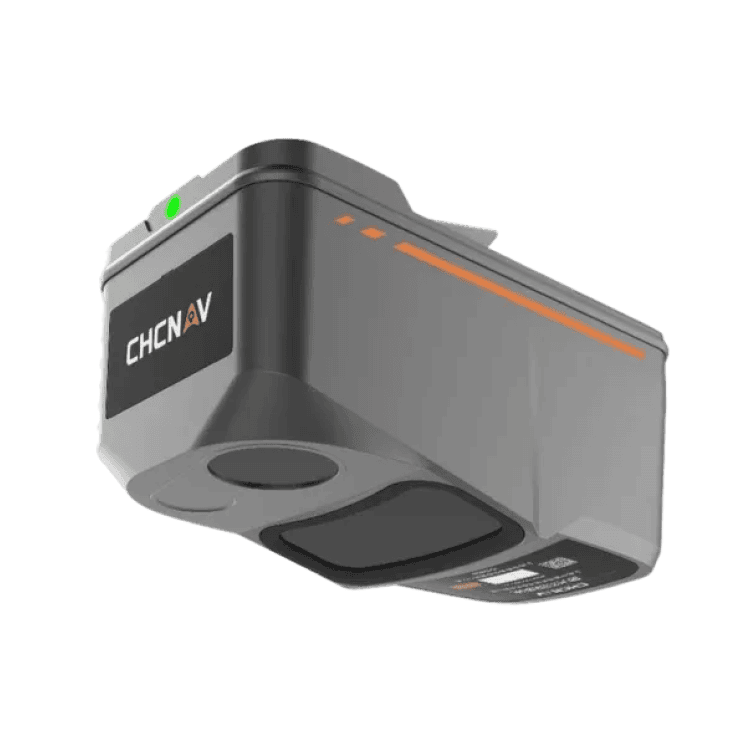
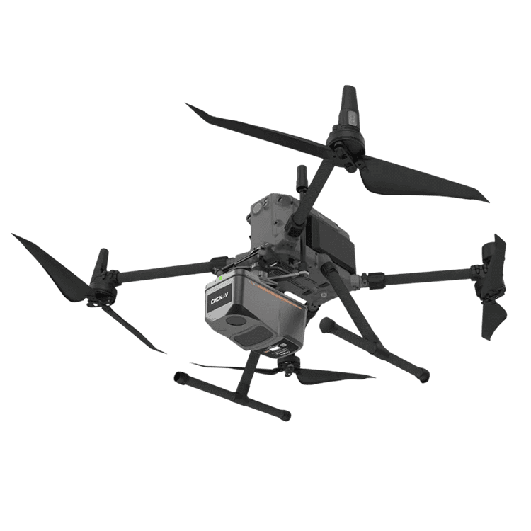
Advanced aerial surveying solution featuring LiDAR and RGB sensors to meet the needs of professional UAV LiDAR mapping and drone photogrammetry. The AA9 flawlessly integrates high-precision CHCNAV’s LiDAR, accurate GNSS positioning, IMU orientation and an industrial-grade half-frame orthophoto camera. Combined with CHCNAV point cloud and image fusion modeling software, the AA9 provides a survey-grade, efficient and cost-effective approach to 3D data acquisition and processing.
Specification
Flexible UAV Setup
AA9 is compact and lightweight LiDAR that can be easily installed on various drones like CHCNAV BB4, or popular DJI Matrice or any 3rd party UAVs.
Global GNSS/GPS
Trible band, all constellations, L-band
Easy to Use
This easy-to-use LiDAR software is designed to make it easier for users to process, analyze, and interpret LiDAR data.
26 MP Half-Frame Camera
Industrial camera in one solution gives ability to users to generate accurate and realistic 3D models and high-resolution DOM.
Industrial Reliability
AA9 offer the highest levels of protection and operational performance in any field environment. Survey missions can face unexpected weather surprises, and AA9 are designed to exxcel in any situation, always ensuring reliable performance.
Alphaport Interface
Interface integrates power supply and connection to drone telemetry without any cables.